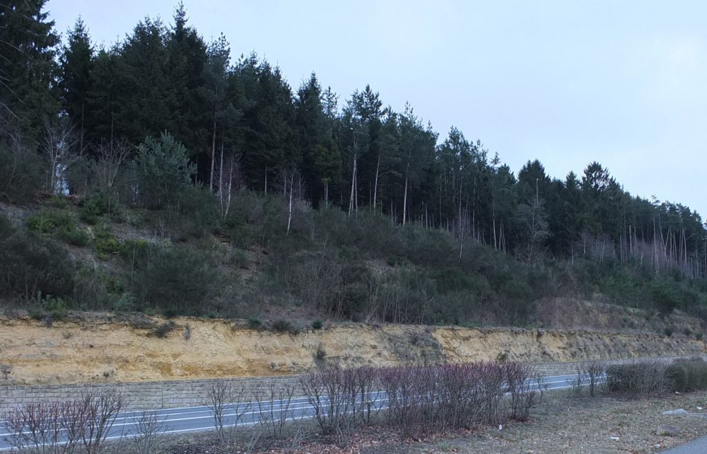
The Luxembourg Sandstone ends abruptly at this location and the topography drops steeply down. Such a terrace is called a cuesta. Below the ridge the lower-lying, gently-undulating landscape of colourful marls is observable and predominantly used for agriculture.
With favourable meteoric conditions it is possible to see the “Widdebierg” mountain (the highest elevation) near Flaxweiler, in 12 km to the south. This peak is also again of Luxembourg Sandstone. On the opposite side of the road, the Luxembourg Sandstone can easily be recognized by its yellow colour and stratification. At this location, however, it has to a large extent disintegrated due to alteration into sand. Typical trees growing on such substrate are common broom and Scots pine.
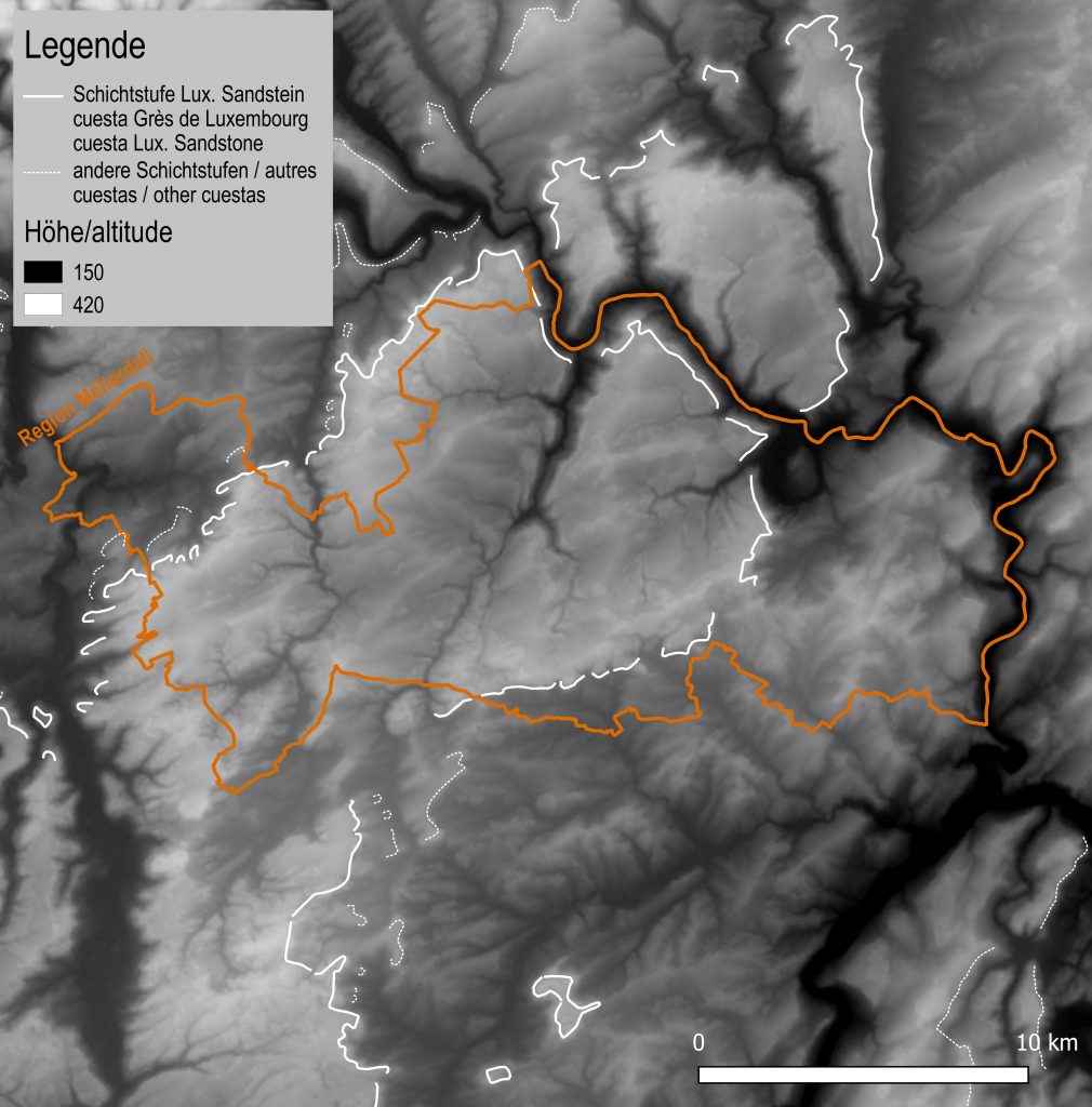
In the region the geological lithologies lie onionskin-like, one above the other and form a bowl structure (“syncline”). Luxembourg Sandstone from the Liassic period forms the centre. This lithological unit is divided up into individual plateaus by a number of streams.
Due to its hardness and weathering resistance, the Luxembourg Sandstone always forms a cuesta at its end. In the region the cuesta forms a narrow arc around the sandstone (white lines on the map). Within the Nature & Geopark one distinguishes between a southern and a northern cuesta. The two cuestas are only separated by about 10 km.