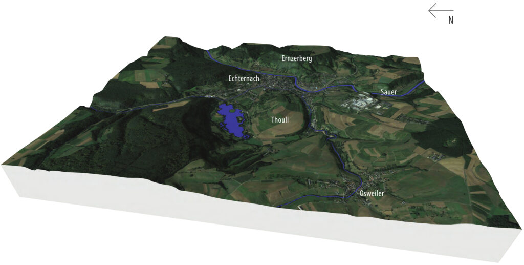
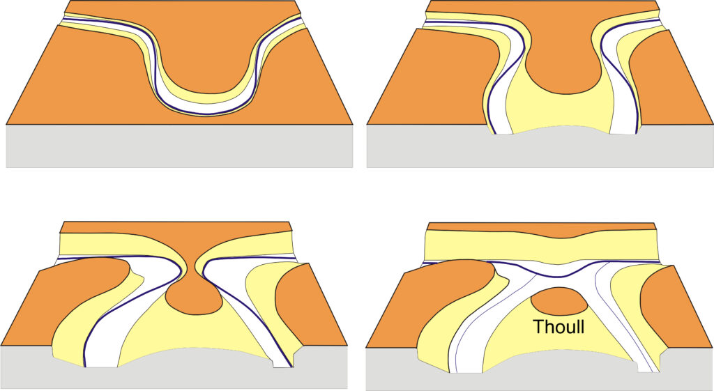
South of Echternach, two small streams flow through a wide valley around the “Thoull” hill. The present Echternach lake was created here in the 1970s. The valley has however a long history: It was formed because over the last 20 million years by the river Sauer and its tributary streams which have carved their way deep into the subsoil. Until about 25,000 years ago, during the last ice age, the Sauer flowed in a large loop (meander) around Thoull hill. Since the Sauer diverted from its original path, the large valley gets drained by two smaller streams and emptying further north into the present-day Sauer.
The geological strata are here dipping towards the west, as a result the subsoil consists of different rock types. To the west of Thoull hill, the subsoil is formed of easily-weathering marls, which is the reason why the valley is wide in these rocks. In contrast, the river is narrow in the east, because dolomite – is a much harder rock – is more difficult to erode.
In the past so much material was eroded by the strong current of the Sauer on the outer curves of the narrow bends (“undercut slopes”) at the foot of the Ernzerberg, that the two bends came closer and closer together. Finally, a breakthrough occurred. Since then, the Sauer has been bypassing the loop while flowing straight on at this point.