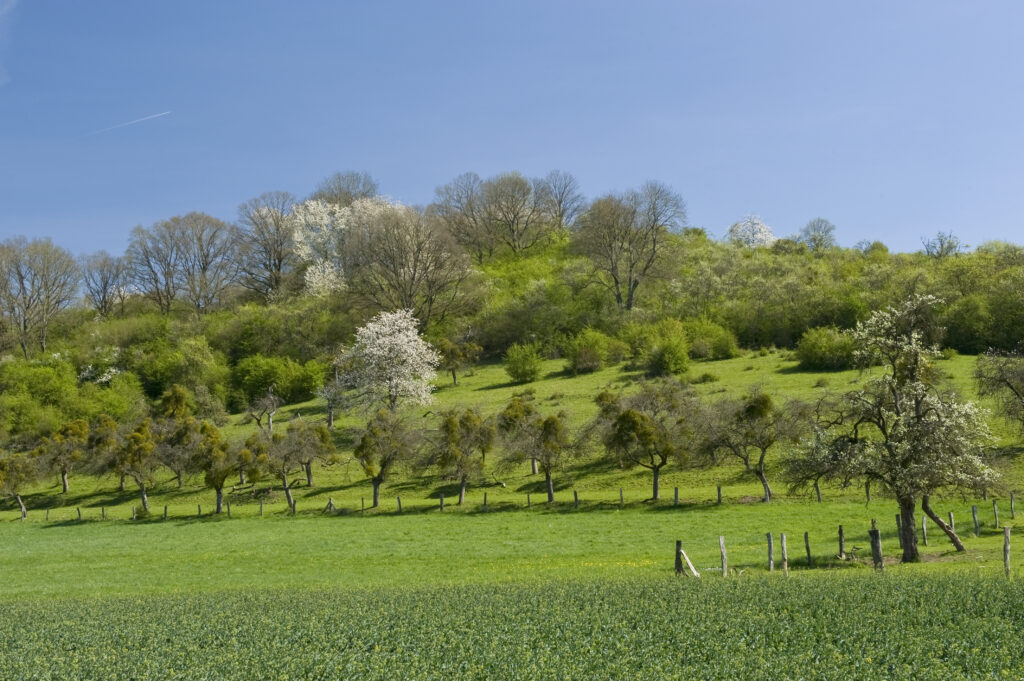
The region stands out not only with its imposing rocks and gorges, but also with the traditional orchard meadows (bongerten) and their hundreds of fruit varieties, large forests, unique fern and moss flora, natural forest reserves and a land area of 42 % Natura2000 areas. In addition, one finds here the remains of the “oldest Luxembourgers”. The oldest town in Luxembourg, the intangible world cultural heritage “the hopping procession of Echternach”, the castles and palaces of Beaufort and Larochette, Echternach Abbey with its illuminated books, and relics of early industries such as the iron and textile industry, can be found here. Last but not least, this historic tourism region can be explored on award-winning hiking trails, some of which date from the 19th century. Here, you may discover selected examples of our natural and cultural heritage!
Thank you for respecting our beautiful landscapes. You can find more information ob the rules of conduct here.
A large part of the dolomite rocks, limited by the joint system, slid and tilted on the marly layer underneath in the direction of the valley and opened up a […]
A large part of the dolomite rocks, limited by the joint system, slid and tilted on the marly layer underneath in the direction of the valley and opened up a […]
A large part of the dolomite rocks, limited by the joint system, slid and tilted on the marly layer underneath […]
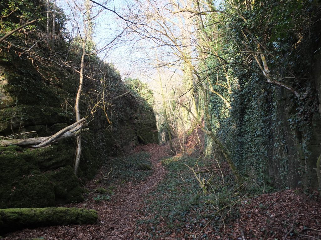
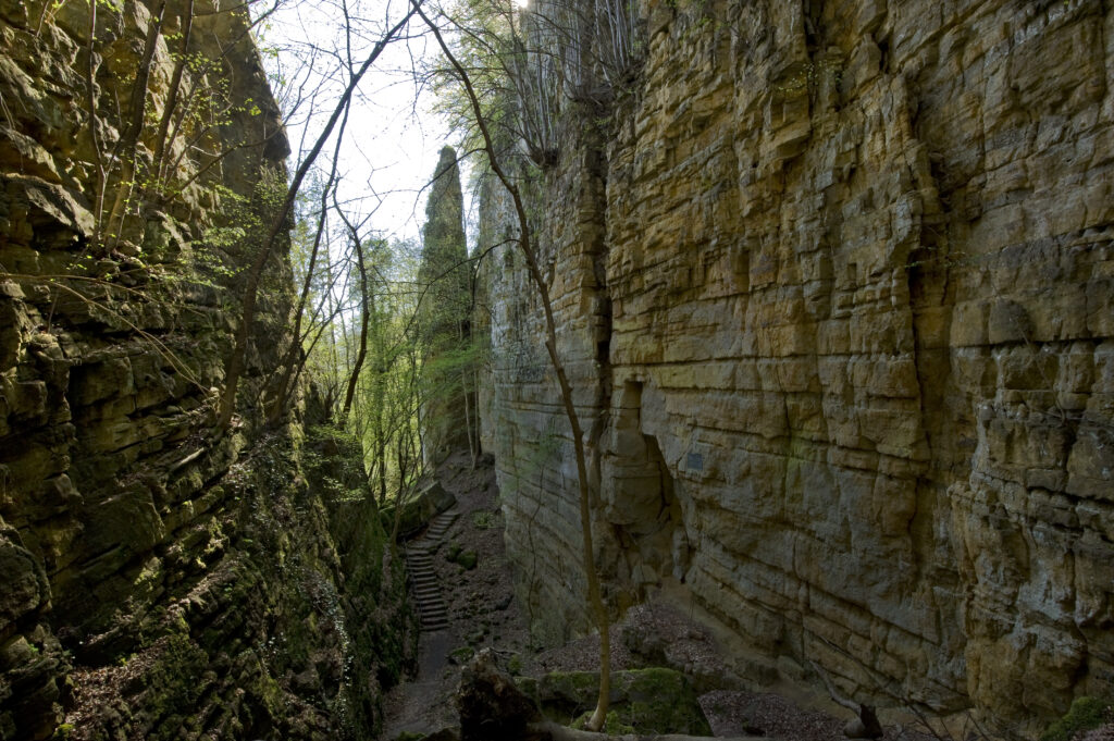
The area of the Wanterbaach and Siweschlëff is certainly one of the most impressive parts of the landscape in the Luxembourg sandstone. The steep rock faces and the narrow gorges […]
The area of the Wanterbaach and Siweschlëff is certainly one of the most impressive parts of the landscape in the Luxembourg sandstone. The steep rock faces and the narrow gorges […]
The area of the Wanterbaach and Siweschlëff is certainly one of the most impressive parts of the landscape in the […]
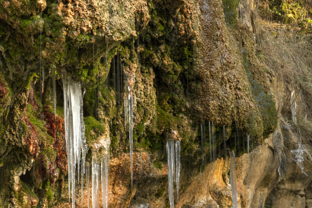
Calcareous tufa springs are rare and special habitats that are home to a variety of specialised creatures and are protected EU-wide protection (FFH Directive). At the source of the spring, […]
Calcareous tufa springs are rare and special habitats that are home to a variety of specialised creatures and are protected EU-wide protection (FFH Directive). At the source of the spring, […]
Calcareous tufa springs are rare and special habitats that are home to a variety of specialised creatures and are protected […]
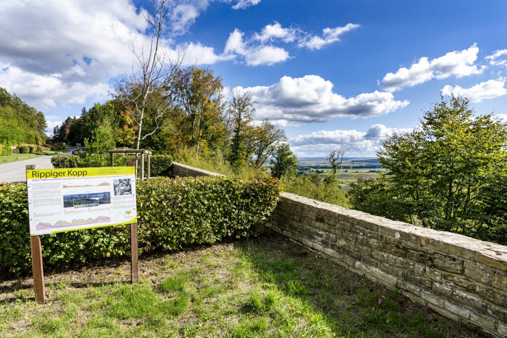
The rocky landscape of the Noumerleeën delimits the distribution area of the Luxembourg sandstone in the Natur- & Geopark Mëllerdall. To the northwest, the gently undulating landscapes of the marls […]
The rocky landscape of the Noumerleeën delimits the distribution area of the Luxembourg sandstone in the Natur- & Geopark Mëllerdall. To the northwest, the gently undulating landscapes of the marls […]
The rocky landscape of the Noumerleeën delimits the distribution area of the Luxembourg sandstone in the Natur- & Geopark Mëllerdall. […]
At the Schéissendëmpel with its stone bridge, the water of the Black Ernz stream flows over some large boulders lying in the stream bed. They cannot be carried away by […]
At the Schéissendëmpel with its stone bridge, the water of the Black Ernz stream flows over some large boulders lying in the stream bed. They cannot be carried away by […]
At the Schéissendëmpel with its stone bridge, the water of the Black Ernz stream flows over some large boulders lying […]
Fischbach is one of Luxembourg’s early industrial centres: until 1857, bog iron orefrom the Mersch area was smelted here in blast furnaces. The blast furnace was located in the area […]
Fischbach is one of Luxembourg’s early industrial centres: until 1857, bog iron orefrom the Mersch area was smelted here in blast furnaces. The blast furnace was located in the area […]
Fischbach is one of Luxembourg’s early industrial centres: until 1857, bog iron orefrom the Mersch area was smelted here in […]
The steep rock cliffs of the up to 40-metre deep “Wolf’s Gorge” consist of Luxembourg sandstone (li2). While the sandstone forms the “Érelchen” plateau, the lower part of the slope […]
The steep rock cliffs of the up to 40-metre deep “Wolf’s Gorge” consist of Luxembourg sandstone (li2). While the sandstone forms the “Érelchen” plateau, the lower part of the slope […]
The steep rock cliffs of the up to 40-metre deep “Wolf’s Gorge” consist of Luxembourg sandstone (li2). While the sandstone […]
South of Echternach, two small streams flow through a wide valley around the “Thoull” hill. The present Echternach lake was created here in the 1970s. The valley has however a […]
South of Echternach, two small streams flow through a wide valley around the “Thoull” hill. The present Echternach lake was created here in the 1970s. The valley has however a […]
South of Echternach, two small streams flow through a wide valley around the “Thoull” hill. The present Echternach lake was […]
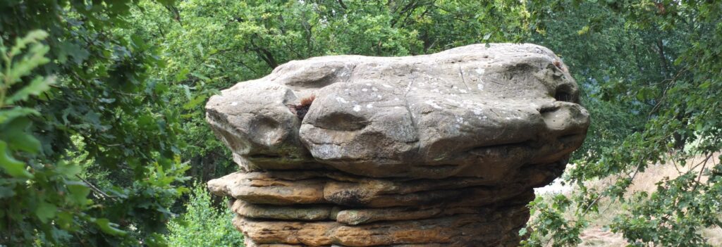
The Champignon is a solitary boulder of Luxembourg sandstone in the shape of a mushroom. It is the weathering remnant of this sandstone layer, which originally extended further north here. […]
The Champignon is a solitary boulder of Luxembourg sandstone in the shape of a mushroom. It is the weathering remnant of this sandstone layer, which originally extended further north here. […]
The Champignon is a solitary boulder of Luxembourg sandstone in the shape of a mushroom. It is the weathering remnant […]
The Luxembourg Sandstone ends abruptly at this location and the topography drops steeply down. Such a terrace is called a cuesta. Below the ridge the lower-lying, gently-undulating landscape of colourful […]
The Luxembourg Sandstone ends abruptly at this location and the topography drops steeply down. Such a terrace is called a cuesta. Below the ridge the lower-lying, gently-undulating landscape of colourful […]
The Luxembourg Sandstone ends abruptly at this location and the topography drops steeply down. Such a terrace is called a […]
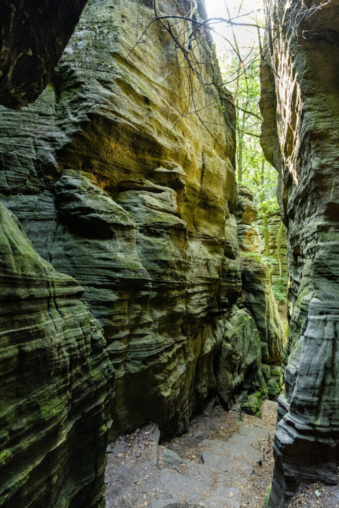
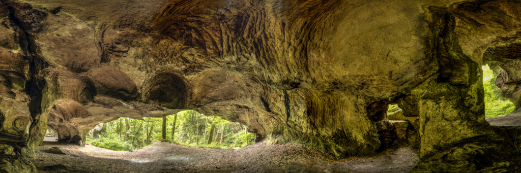
The Kuelscheier is a narrow, pitch-dark rock crevice in the Luxembourg sandstone. It runs over a distance of about 100 metres parallel to the valley of the Härdbaach stream. The […]
The Kuelscheier is a narrow, pitch-dark rock crevice in the Luxembourg sandstone. It runs over a distance of about 100 metres parallel to the valley of the Härdbaach stream. The […]
The Kuelscheier is a narrow, pitch-dark rock crevice in the Luxembourg sandstone. It runs over a distance of about 100 […]
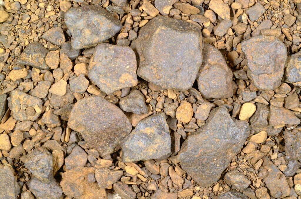
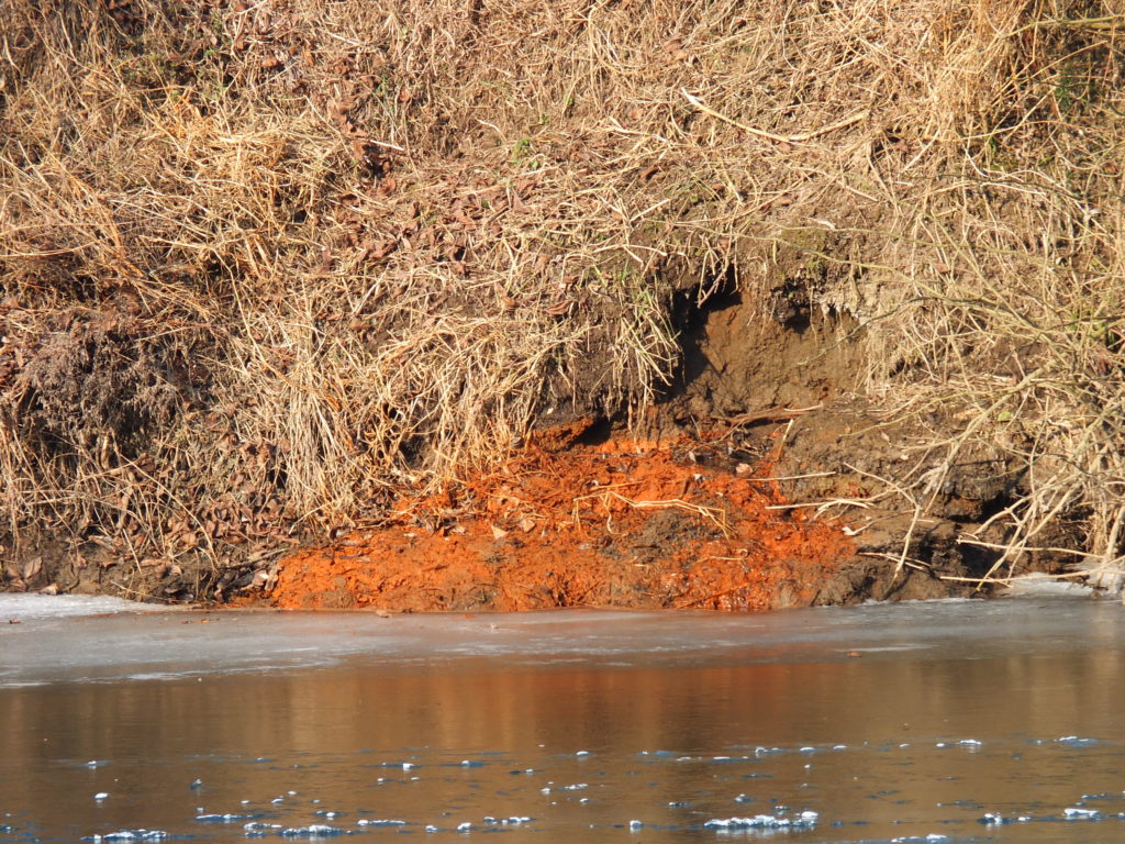
The oldest rocks in the region can be observed: red sandstones from the Lower Triassic (“Buntsandstein”). The red colour is due to oxidyzed iron concentrations in the rock. These older […]
The oldest rocks in the region can be observed: red sandstones from the Lower Triassic (“Buntsandstein”). The red colour is due to oxidyzed iron concentrations in the rock. These older […]
The oldest rocks in the region can be observed: red sandstones from the Lower Triassic (“Buntsandstein”). The red colour is […]
Mainly in the 1940s and 1950s gypsum was mined underground in a gallery on the slope of the Giischterbësch forest. The extracted gypsum was transported in wagons via a braking […]
Mainly in the 1940s and 1950s gypsum was mined underground in a gallery on the slope of the Giischterbësch forest. The extracted gypsum was transported in wagons via a braking […]
Mainly in the 1940s and 1950s gypsum was mined underground in a gallery on the slope of the Giischterbësch forest. […]
Salt was extracted near Born between the 16th and 18th centuries by means of a brine concentrating system. This is proven by a concession certificate dating from 1585. Salt mining was possible here because salt rich springs waters occur at various places on the river Sauer. One of the springs supplied a sufficiently large amount of water with a high enough salt content. Today, […]
Salt was extracted near Born between the 16th and 18th centuries by means of a brine concentrating system. This is proven by a concession certificate dating from 1585. Salt mining was possible here because salt rich springs waters occur at various places on the river Sauer. One of the springs supplied a sufficiently large amount of water with a high enough salt content. Today, [...]
Salt was extracted near Born between the 16th and 18th centuries by means of a brine concentrating system. This is proven by a concession certificate dating from 1585. Salt mining was possible here because salt rich springs waters occur at various places on the river Sauer. One of the springs supplied a sufficiently large amount of water with a high enough salt content. Today, [...]
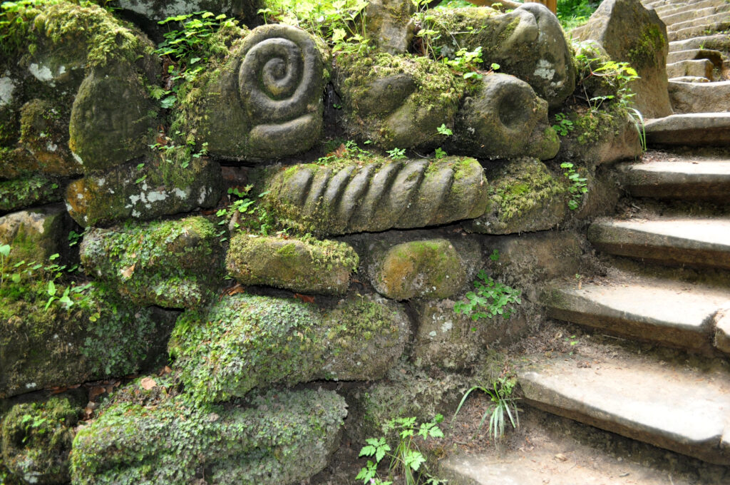
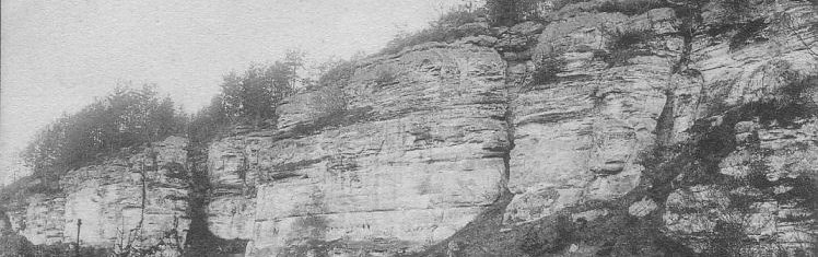
Various strata of Luxembourg sandstone are suitable for use as quarry- and building-stones. Sandstone was extracted in the Beaufort and Dillingen quarries until the 1970s. The stones were used in […]
Various strata of Luxembourg sandstone are suitable for use as quarry- and building-stones. Sandstone was extracted in the Beaufort and Dillingen quarries until the 1970s. The stones were used in […]
Various strata of Luxembourg sandstone are suitable for use as quarry- and building-stones. Sandstone was extracted in the Beaufort and […]
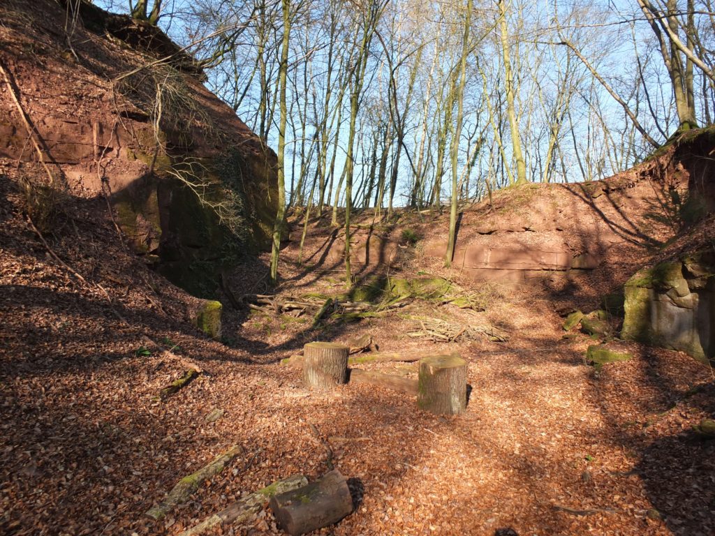
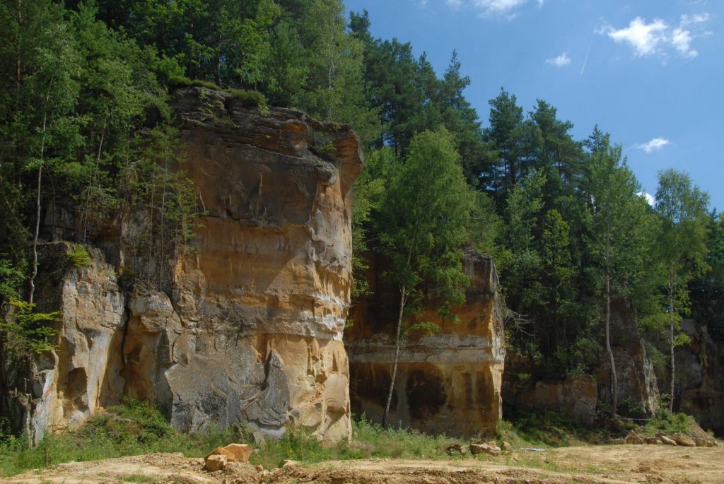
The Huel Lee quarry is a characteristic feature. Etymologically, the name denotes a hollow rock. Over the centuries, rough stones were broken here from a particularly abrasion-resistant stratum of Luxembourg […]
The Huel Lee quarry is a characteristic feature. Etymologically, the name denotes a hollow rock. Over the centuries, rough stones were broken here from a particularly abrasion-resistant stratum of Luxembourg […]
The Huel Lee quarry is a characteristic feature. Etymologically, the name denotes a hollow rock. Over the centuries, rough stones […]